
| Home | |
| Who We Are | |
| Historic
Watershed Maps |
|
| Activities |
|
| you are here: home > | |
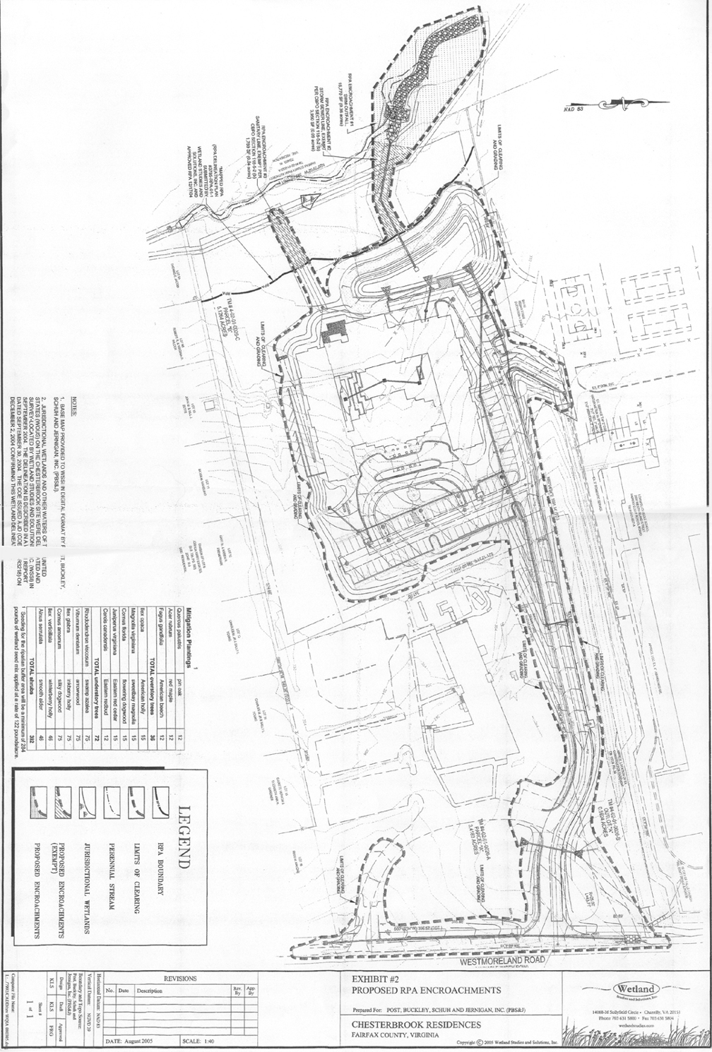
As part of the process of determining "adequate outfall" from the CRI stormwater pond (i.e. making sure the stream channel is able to handle the expected flows from the pond without undue erosion), County staff have asked CRI to install riprap (the large gray rocks already present in the Burke's Spring Branch channel above and below Kirby Rd.) in the section of the Burke's Spring Branch channel that flows through Haycock/Longfellow Park just downstream of the CRI site, near the bridge behind Longfellow Middle School. The current plan, pictured below, also calls for "clearing and grading" -- cutting down trees -- in this highly visible area, an approach that will be especially disappointing to neighbors who asked in testimony that the project be designed so as to have minimum visual impact on the park.
|
|
| Home | Watershed Map & Areas of Interest/Concern |
Historic Watershed Maps | Activities | Contact/Join Us |
All items copyright © 2003-2005
Friends of Burke's Spring Branch unless another source is noted.
Copyright for items with identified authorship remains with the
author(s); historical and other documents reproduced here are, to
the best knowledge of the webmaster, in the public domain. Items
under Friends of Burke's Spring Branch copyright may be reproduced
for nonprofit research or educational use as long as this copyright
notice is included. Please direct comments and questions to Cathy
Saunders. |