| Home | |
| Who We Are | |
| Historic
Watershed Maps |
|
| Activities |
|
| you are here: home > historic watershed maps > 1956 fairfax county property/zoning map | |
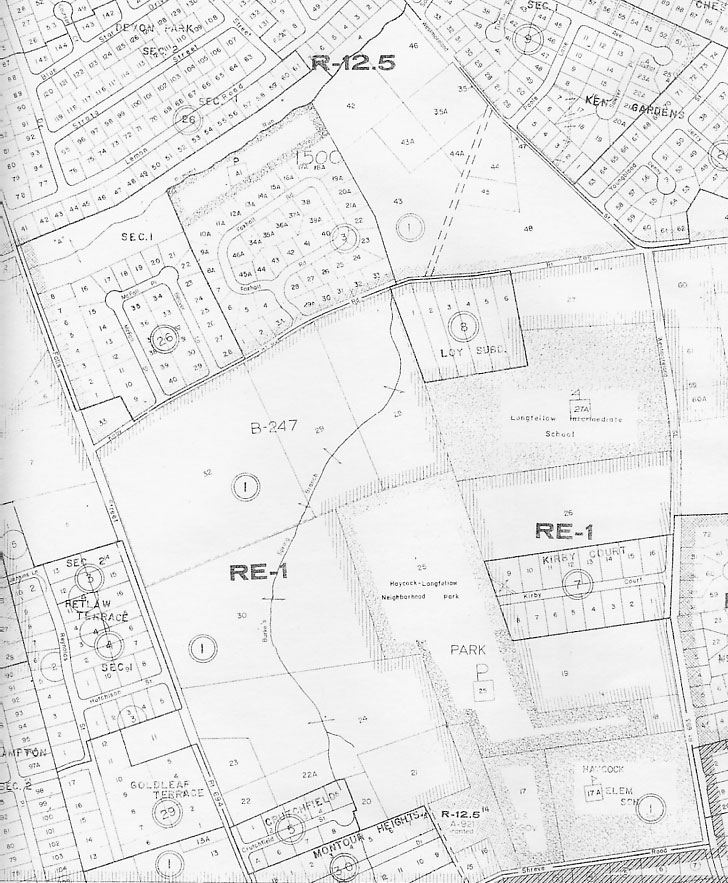
This 1956 Fairfax County Property/Zoning map clearly shows not only the main channel of the western fork of Burke's Spring Branch, but also the side channel leading from Burke's Spring into the branch. Oddly, the only part of the eastern fork shown is the underground culvert (indicated with dotted lines) carrying it under lot 9 of Kirby Ct.
|
|
| Home | Watershed Map & Areas of Interest/Concern |
Historic Watershed Maps | Activities | Contact/Join Us |
All items copyright © 2003-2005
Friends of Burke's Spring Branch unless another source is noted.
Copyright for items with identified authorship remains with the
author(s); historical and other documents reproduced here are, to
the best knowledge of the webmaster, in the public domain. Items
under Friends of Burke's Spring Branch copyright may be reproduced
for nonprofit research or educational use as long as this copyright
notice is included. Please direct comments and questions to Cathy
Saunders. |