Erosion from Stockwell Manor Site --
October 7 & 8, 2005
| Home | |
| Who We Are | |
| Historic
Watershed Maps |
|
| Activities |
|
| you are here: home > stockwell manor erosion page 2 | |||
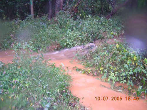
Since clearing had recently begun for Camberley Homes' Stockwell Manor subdivision, that site was the most obvious possible source for the sedimented water. Investigations further upstream confirmed that hunch. At the confluence of the two forks of Burke's Spring Branch on Brooks Square's common land, flow from the eastern fork (the horizontal band across the middle of the picture below) was transparent, revealing the dark brown of the streambed below, while flow from the western fork (emerging from the bottom of the picture) was the same cloudy orange visible at the mouth of the stream:
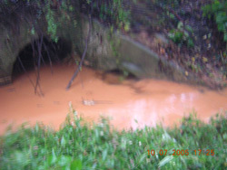
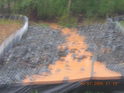
The same pattern was evident just downstream of the construction site, where a small clear flow from a side channel (probably the outlet to storm drains in the area) was briefly visible before being subsumed in the overwhelming orange tide emerging from under Hutchison St. (left). Above Hutchison St., on the site itself (right), the main channel of the stream ran solid orange:
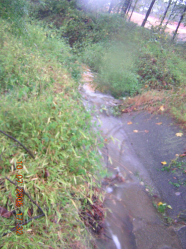
Above the construction site, in the concreted stormwater channels at the foot of Crutchfield St., flow was again clear, though there seemed to be a bit of orangish overland flow from the direction of the construction site entering the channel from the side just at the point where the concrete gives way to riprap (on the right in the picture below):
So, the orangish water did, indeed, seem to be coming from the Stockwell Manor site. But how serious a problem did the orange color indicate? Was it what the site inspectors call "colored water" -- water carrying small particles that, although they do real damage to stream habitats, are hard to control -- or were larger amounts of sediment being transported? Observations after the storm seem to provide some answers.
|
|||
| Home | Watershed Map & Areas of Interest/Concern |
Historic Watershed Maps | Activities | Contact/Join Us |
All items copyright © 2003-2005
Friends of Burke's Spring Branch unless another source is noted.
Copyright for items with identified authorship remains with the
author(s); historical and other documents reproduced here are, to
the best knowledge of the webmaster, in the public domain. Items
under Friends of Burke's Spring Branch copyright may be reproduced
for nonprofit research or educational use as long as this copyright
notice is included. Please direct comments and questions to Cathy
Saunders. |