| Historic
Watershed Maps |
|
| Activities |
|
| you are here: home > areas of interest/concern > Brooks Square stormwater easement | |
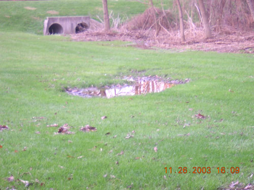
The confluence (coming together) of the two forks of Burke's Spring Branch occurs on the common land of the Brooks Square community. This stormwater easement is partly wooded and partly grassy, with a berm at the downstream end, pierced by two pipes that control the rate of flow from the easement during times of heavy rain. Like other stormwater ponds, the grassy area is designed to allow retained water to infiltrate into the soil over a period of, at most, a few days. However, it, and the wooded area behind it, now receive much more water than they were designed to handle, resulting in several problems. The first problem is evident in the permanent mudhole, and a number of smaller persistent puddles, visible in the grassy area in the picture below. The wetness in this area makes it hard to maintain the area as intended, by mowing, and, in summer, creates a possible breeding ground for mosquitoes.
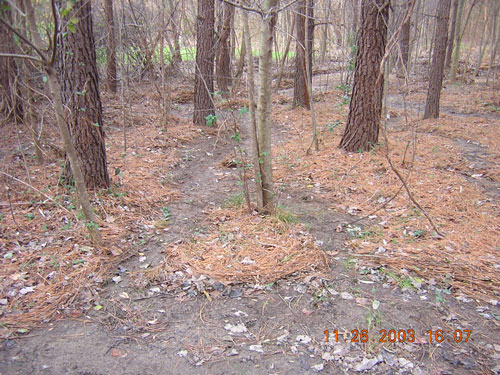
The wooded portion of the easement also receives a great deal of water, almost certainly more than it was designed to handle. The braiding of water as it spreads over the flat area, traced in the pine needles on the forest floor in the picture below, is a natural phenomenon, and probably indicates that the easement is functioning as designed.
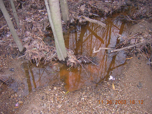
However, this area also has some persistent, nonflowing, puddles, as seen below:
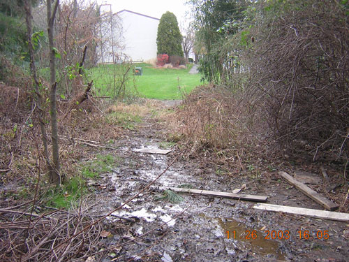
And, perhaps most troublesome to Brooks Square residents, a path through the wooded section connecting their common land to the park has become so muddy, even during dry periods, as to be unusable. A fairweather crossing -- concrete pilons raised above a concrete channel -- makes it possible to cross the stream dry-shod at this point, but the adjoining area can't be navigated without the help of boots, or the boards shown below:
|
|
| Home | Watershed Map & Areas of Interest/Concern |
Historic Watershed Maps | Activities | Contact/Join Us |
All items copyright © 2003-2005
Friends of Burke's Spring Branch unless another source is noted.
Copyright for items with identified authorship remains with the
author(s); historical and other documents reproduced here are, to
the best knowledge of the webmaster, in the public domain. Items
under Friends of Burke's Spring Branch copyright may be reproduced
for nonprofit research or educational use as long as this copyright
notice is included. Please direct comments and questions to Cathy
Saunders. |