| Historic
Watershed Maps |
|
| Activities |
|
| you are here: home >areas of interest/concern > Burke's Spring > Burke's Spring (page 2) > Burke's Spring (page 3) | |
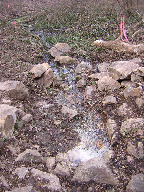
The flow from the spring emerges from under the springhouse foundations, joins the flow from a second small spring 10-15 ft. to the west, and continues north/northwest to join the flow from the concrete stormwater channels that drain the land to the north. The picture immediately below was taken standing within the springhouse foundations, looking downstream toward the point where the channels from the two springs join. The dark green in the foreground is English Ivy, an invasive alien plant that needs to be removed; the light green farther in the distance is watercress, a plant (also non-native) that requires very wet soil, and hence serves as an indicator that the flow from the spring is perennial.
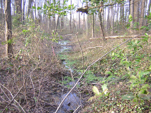
The next picture is taken just above the second spring, and shows its downstream flow, with the flow from Burke's Spring coming in from the right in the lower half of the picture. The flow from the two springs then heads toward the confluence with the flow from the stormwater channels, which is visible in the distance here. As you can see, this area is quite wet, with a small area of wetland (home to more watercress) surrounding the confluence. Even if it weren't important to preserve the spring, this doesn't seem like the best place to build a road, as called for in Winchester's plan.
For a few more thoughts about the spring and its surroundings, go to page 4. |
|
| Home | Watershed Map & Areas of Interest/Concern |
Historic Watershed Maps | Activities | Contact/Join Us |
All items copyright © 2003-2005
Friends of Burke's Spring Branch unless another source is noted.
Copyright for items with identified authorship remains with the
author(s); historical and other documents reproduced here are, to
the best knowledge of the webmaster, in the public domain. Items
under Friends of Burke's Spring Branch copyright may be reproduced
for nonprofit research or educational use as long as this copyright
notice is included. Please direct comments and questions to Cathy
Saunders. |

