| Historic
Watershed Maps |
|
| Activities |
|
| you are here: home > areas of interest/concern > McLean Greens SWP to confluence | |
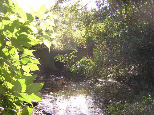
One of the most interesting, and puzzling, sections of Burke's Spring Branch lies between the outlet of the McLean Greens stormwater pond and the confluence of the western and eastern forks of the Branch on the Brooks Square stormwater easement. This section begins with the pool pictured below, approximately 10-12 feet in diameter, that forms just below the stormwater pond outlet. While the surface of this pool often looks quite still, there is, even in relatively dry periods, a steady flow of water out of the pipe, and a corresponding flow over a little waterfall at the downstream end of the pool.
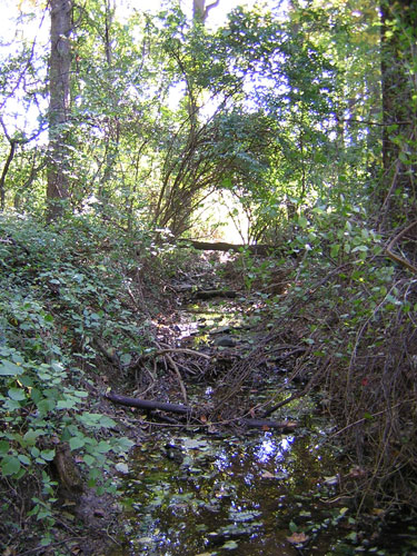
Below this point, the stream proceeds for several hundred feet, curving and alternating between riffles and pools. As you can see from the picture below, the stream is quite wide -- 3 feet or more -- in this section.
As it passes through the McLean Province common land, the stream becomes more sinuous -- working its way through a series of curves -- and, unless there has been recent rain, the surface flow narrows considerably, following the deepest part of the channel. The channel itself, however, remains quite wide and deep, with evidence of erosion along the sides, and extensive gravelly bars within the channel, both seen in the picture below.
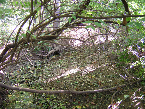
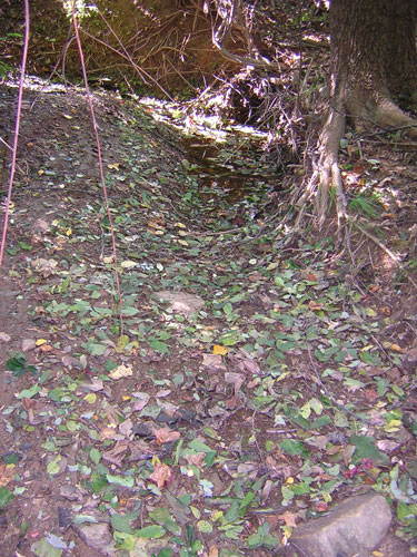
After several such curves, the stream becomes straighter for a section, before taking a final turn toward the east. In periods of lower flow, this part of the stream is frequently dry, even when there is a steady flow of water from the pond upstream. This was the case in October of 2003, when all the pictures on this page were taken; the final pool of water, nestled in a curve, is shown below. It's not clear why this phenomenon occurs, but it's clear that the water is going somewhere. The most likely explanation seems to lie in the gravelly, sandy soil in this area, which may allow the stream to duck underground, rejoining the Branch, or perhaps Pimmit Run, by an unseen channel. As mentioned in the Friends of Burke's Spring Branch's Dec. 2003 testimony before the Fairfax County Environmental Quality Advisory Council, this section caused some confusion during the Fairfax County perennial survey, when teams working their way upstream encountered a dry streambed just above the confluence of the two forks, and concluded that they had reached the limits of the stream's perennial flow. However, as is clear from the pictures on this page, the reach just below the McLean Greens stormwater pond, as welll as the reaches above and below Hutchison street, all fed by the flow from Burke's Spring, can be quite full of water even when the reaches immediately downstream are dry.
|
|
| Home | Watershed Map & Areas of Interest/Concern |
Historic Watershed Maps | Activities | Contact/Join Us |
All items copyright © 2003-2005
Friends of Burke's Spring Branch unless another source is noted.
Copyright for items with identified authorship remains with the
author(s); historical and other documents reproduced here are, to
the best knowledge of the webmaster, in the public domain. Items
under Friends of Burke's Spring Branch copyright may be reproduced
for nonprofit research or educational use as long as this copyright
notice is included. Please direct comments and questions to Cathy
Saunders. |